
Seven Waterfalls
Tiffany,
Sherman,
Websters,
Tews,
Canterbury,
Baby Websters,
and Heritage
 This is a car shuttle hike, please bring your cars, we will need them
for the shuttles. If you are driving directly
(not going to Yonge and York Mills),
please drive to Tews Falls.
This is a car shuttle hike, please bring your cars, we will need them
for the shuttles. If you are driving directly
(not going to Yonge and York Mills),
please drive to Tews Falls.
We will drop half the cars at Tews Falls, drive to Tiffany, then hike
back to Tews. This is a medium to difficult hike. The hike is about
14.8 kilometers long, making it one of our longer hikes. It could
set a new standard for mud. Wear your hiking boots. On the positive
side, the waterfalls could be at their best.
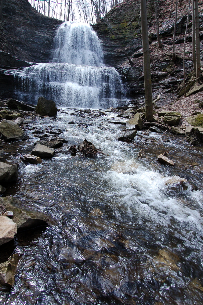
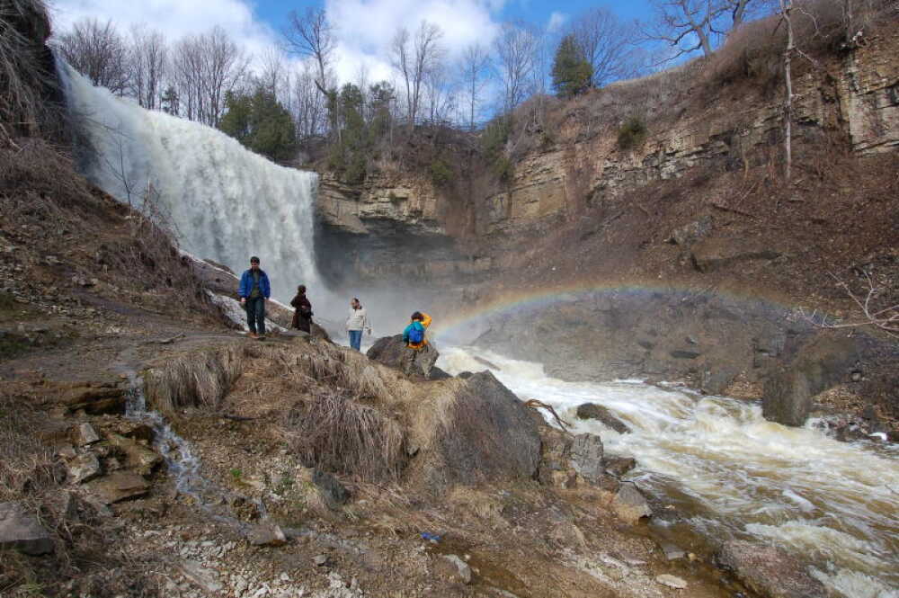
The two waterfalls photographed on this page are Sherman Falls and
Webster's Falls.
Directions to Tews Falls
-
Take Highway 401 to Highway 403.
-
Take Highway 403 to its (temporary) end at the QEW, and go
west on the QEW
-
Near Hamilton, the QEW splits into two expressways. Stay to the right,
highway 403. Do not take the left lanes. They are the QEW as it
goes over the Burlington Skyway toward Niagara.
-
A few kilometers later, take Highway 6 north.
-
The first major intersection is Dundas Street, Highway 5.
Turn left, west.
-
Make a left at Sydenham, south.
-
Sydenham will turn right and head west. Then there is a second turn
where Sydenham will turn left and head south. Do not take this
second turn
-
Head straight west onto Harvest. The Tews Falls parking lot is on the
left.
Directions to Tiffany Falls
 This is from Tews Falls
- Turn right onto Harvest, east.
- At the triangle intersection turn right onto Sydenham, south.
- At King turn left, east.
- short distance along, turn right onto Main, south.
-
Main will change names to Osler. At Main Street West, turn
right, south.
-
A kilometer or two later, the Tiffany Falls parking lot is on the left.
It is about a hundred yards beyond Harper's Gardening Centre.
The Hike
The hike is on the Bruce Trail. It incorporates most of the Sulphur
Springs (Dundas South) and Websters Falls (Dundas North) hikes. The
hike starts on the north side of Main St West. Then we go left, west.
We will stay on the Bruce Trail all day.
At the end of the hike we could add on an extra 2 km to take in the
Dundas Peak lookout (fat chance).
Then, we will do the post hike car shuttle.
The Post Hike
There is a good Kelsey's Bar not too far away.
- Go east back to Main Street.
- Turn right, east, onto Main.
- Less than a kilometer later, cross Longwood Road.
-
On the right is the restaurant/bar with an outdoor deck. The food
ain't bad at all.
To Get Back onto the 403
- Proceed east on Main St.
- While on Main St, cross over the 403.
- Make a left at the first lights, onto Dundurn Street.
- Make quick left onto King Street.
- Then, make a quick right onto the ramp.
Go back to the schedule page.
 This is a car shuttle hike, please bring your cars, we will need them
for the shuttles. If you are driving directly
(not going to Yonge and York Mills),
please drive to Tews Falls.
This is a car shuttle hike, please bring your cars, we will need them
for the shuttles. If you are driving directly
(not going to Yonge and York Mills),
please drive to Tews Falls.
 This is from Tews Falls